|
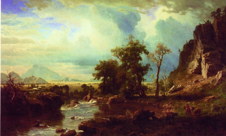
North Fork of the Platte, A. Bierstadt
As indicated in the discussion of Lander and the Wind River Basin
Albert Beirstadt accompanied the 1859 Lander Expedition along the North Platte River and into
the Wind River Basin. Wyoming is unique that it has a triple continental divide; that is
snow falling in Wyoming may ultimately end up in the Gulf of Mexico, the Gulf of California, or the
North Pacific. Three great river systems of North America find their headwaters in the State. The Little
Missouri, the Powder, the Big Horn and the Shoshone Rivers all find their way into the
Missouri-Mississippi River System. The Snake feeds the Mighty Columbia and the Green River, changing its name to the
Colorado, ends in wet years in the Gulf of California. In dryer years it has all the water
sucked out for irrigation and to provide water for the golf courses of Las Vegas and Palm
Springs. But of the various rivers of America one of the most important from an
historical viewpoint is the North Platte. Three of the great western trails followed its
banks, the Oregon, the Mormon, and for a short distance the Cherokee. The North Platte
arises in North Park, Colorado and proceeds northward past Riverside and Saratoga.
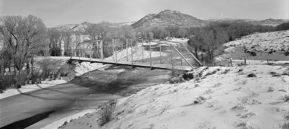
Bridge Near Riverside, Carbon County, Wyo.
Photo courtesy Library of Congress, Prints and Photographs Division
The above bridge built about 1930 replaced an
earlier timber bridge built in 1905. Additional photos of Grand Encampment area on Encampment page.
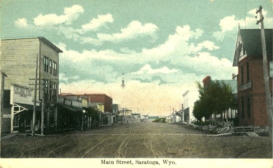
Saratoga, approx 1910
The Wolf Hotel is on the left in the photo.
For another view of the Wolf Hotel see Encampment.
 Undated, Saratoga Undated, Saratoga
The Cherokee Trail was actually two trails, the Northern laid out in 1849 by Capt. Lewis Evans. Four companies from Arkansas and
Oklahoma followed the trail to Fort Bridger and then west to the California
gold fields.
From their days in North Carolina and
North Georgia the Cherokee were familiar with placer mining of gold and, thus, as did the Whites, joined the 1849
gold rush.
The Trail proceeded from Arkansas westward to Bent's Fort, Colorado. From there the trail proceeded westward
to the Front Range where it followed the old Ute Trail from Manitou Springs northward to near present day
Fort Collins. From there it followed the Cache LaPoudre ultimately coming to the North Platte. It then followed
the North Platte northward to the area of present day Saratoga where it crossed the
river and proceeded westward to Fort Bridger.
The Southern Trail established the following year followed the same route to
Fort Collins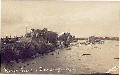 but turned northward at Laporte to the area of present day Tie Sidings and
then westwardly to Saratoga. Neither trail, however, was a great road used by
emigrants but was always a trail used by adventurers and trappers. A third trail
later used Bridger's Pass. but turned northward at Laporte to the area of present day Tie Sidings and
then westwardly to Saratoga. Neither trail, however, was a great road used by
emigrants but was always a trail used by adventurers and trappers. A third trail
later used Bridger's Pass.
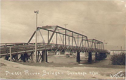
N. Platte at flood, undated
Saratoga, itself, traces its origins to William H. Cadwell who built a bath house for
trappers and travelers passing through the area. In 1878 a post office was established with
the name "Warm Springs." This, however, was changed by Fenimore Chatterton (1860-1958) who named the
area after Saratoga Springs, New York. Chatterton was Secretary of State and upon the death of
Governor DeForest Richards became acting Governor. Chatterton refused commutation of
Tom Horn's death sentence and failed of election in 1905 and was succeeded by
Bryant B. Brooks. Saratoga was incorporated in 1900. Notwithstanding the
warm springs and efforts to make the area a spa, the area has relied primarily on lumbering as
indicated by the logs floating in the river in the photo above right and upon agriculture.
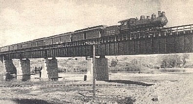 Fort Steele railroad bridge, approx. 1910
Fort Fred Steele, named after Civil War Union General
Frederick Steele, was established in conjunction with the construction of the Union Pacific
Railroad in 1868. Its site was selected by Col. Richard I. Dodge. The Fort was
discontinued in 1886, but the Town remained as a site for a railroad tie and fence
post treatment plant with the timber being floated down the river from the
Medicine Bow Mountains to the south. Later the area also served as a sheep shearing site.
With the establishment of the Lincoln Highway in the area in 1922 the town had a
brief economic resurgence which ended with the relocation of the highway in 1939. Today the
area has been designated as a state historic site with little more remaining but the
foundations of the buildings. Fort Steele railroad bridge, approx. 1910
Fort Fred Steele, named after Civil War Union General
Frederick Steele, was established in conjunction with the construction of the Union Pacific
Railroad in 1868. Its site was selected by Col. Richard I. Dodge. The Fort was
discontinued in 1886, but the Town remained as a site for a railroad tie and fence
post treatment plant with the timber being floated down the river from the
Medicine Bow Mountains to the south. Later the area also served as a sheep shearing site.
With the establishment of the Lincoln Highway in the area in 1922 the town had a
brief economic resurgence which ended with the relocation of the highway in 1939. Today the
area has been designated as a state historic site with little more remaining but the
foundations of the buildings.
North Platte photos continued on next page.
|