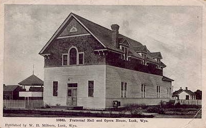
Lusk fraternal hall and opera house
Lusk was founded in 1886, the year before
the discontinuance of the stage line. A settlement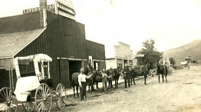 had originally been located
a few miles west near the Silver Cliff Mine. When the railroad came, Frank Lusk,
a local rancher, donated the land for the townsite. had originally been located
a few miles west near the Silver Cliff Mine. When the railroad came, Frank Lusk,
a local rancher, donated the land for the townsite.
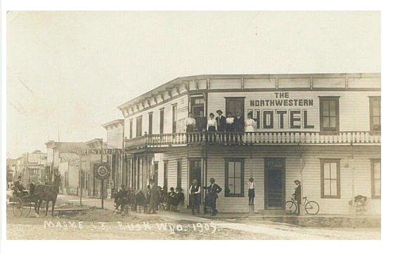
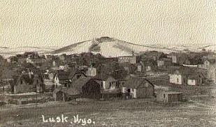
1909 view of Lusk
at the bottom of this page. Undated photo of livery to right.
Note motorcar behind horses. In 1917, oil was discovered
at Lance Creek 20 miles north of Lusk. In 1918, uranium was discovered in copper and
siver tailings in the Silver Cliff Mine. Uranium was milled on site and the
mine provided some of the ore for Madam Curie. Niobrara County is now the smallest county in the state with a population
of approximately 2,500. In the 1940's, at the height of the oil boom had a population
of 10,000. Lance Creek had 2,000 residents, but
by 1985 the population had declined to about 50. Lance Creek is now most noted for
upper Crataceous dinosaurs discoveries at several sites between Lance Creek and
Crazy Woman Creek.
Lusk, circa 1918
Annually, the citizenry of Niobrara County celebrate the "Legend of Rawhide."
According to the "Legend," a wagon train passed through the area in June of 1849 on the
way to the gold fields of California. A young man in the train, having vowed to
kill the first Indian he saw, shot and killed an Indian maiden. The Indians
were, quite naturally, upset about this turn of events and demanded that the culprit be
turned over to them. The wagon party, not believing that one of their members would
have done such a thing, refused. The Indians attacked and were repelled. The Indians
attacked again and then unexpectedly withdraw with wild war-whoops; for the
young man had given himself up to save the train. The Indians skinned him alive, thus,
accounting for the quite aprocryphal naming of nearby Rawhide Creek and
Rawhide Buttes. Another explanation for the naming of Rawhide Creek and Buttes is that
the name originated with the early mountain man name for a dressed out beaver pelt -- rawhide.
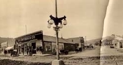 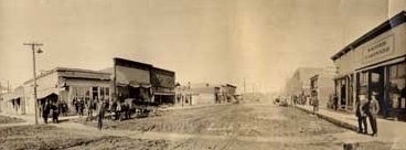
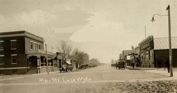
Panoramic view, Lusk, 1920
In the top photo above, across the street from the brick hotel, is H. C. Snyder & Co.,
Groceries (on the right in top photo, on the left in panoramic view). Next door is the Toggery.
Note the change in the street
light. Lusk, itself, during its hayday when Niobrara County had a population of over
10,000, was famous for Dell Burke's Yellow Hotel across from the railroad depot. Miss Dell,
a petite redhead,
born Mary Ada Fisher, arrived in Lusk in 1919, setting up in
a tent. The Yellow Hotel continued in business until 1978. Over the years Miss
Dell contributed anonymously to the needy, bailed out the
power company during the depression, and never operated on Sunday, not wishing
the "boys to come here instead of going to church." At age 91 Miss Dell slipped and fell
on the sidewalk outside her hotel and spent the last several years of
her life in a care center. On her death in 1980 her estate was valued in
excess of $1,000,000. A country song, Dell was a lady was written in her
memory.
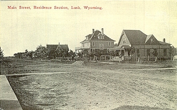
Main Street, residential section, Lusk, 1910
Niobrara County in the 1880's was on the route of the so-called "Texas Trail" from Texas
to Montana and even up into Canada. Following the Civil War there was an excess of
cattle in Texas and, as noted with regard to the discussion of the Goodnight-Loving
Trail, large drives to the railhead towns of Kansas and to Cheyenne began.
With the construction of railroads in Montana and the Dakotas providing ready
access to the eastern markets and the discovery
that cattle would thrive on the northern plains, a demand arose for drives for the purpose of stocking
the northern ranges. With farming taking over the eastern plains of Kansas the
trails moved west. One of the greatest of these was the "Western Trail," sometimes referred
to as the Western Chisholm Trail, named after Jessie Chisholm, not to be
confused with John Chissum of Lincoln County War fame in New Mexico.
The Trail, originally blazed by John Lytle in 1874, was not a
clearly defined road or path, in the sense, say, of I-25. Sometimes it would
be over twenty miles wide, running from Texas northward, with various branches, all
ultimately leading to Ogallala, the "Gomorrah" of the west. The town was so bad that
at least one cattle company which on drives would allow its boys the freedom of
Dodge City, declared it off limits, thus giving the town the reputation of being
"too tough for Texas." Indeed, the owner of one hotel told an eastern
visitor that there was only one woman in town, the hotel owner's wife, all the others
were "ladies." The "ladies" would usually be brought in from Omaha for the "season."
From Ogallala the trails would split off. One followed the Platte to Fort Laramie and westwardly
to provide cattle for the Fort Washakie and Crow agencies in Wyoming. Another
crossed the Niabrara River and ultimatly connected to the Cheyenne River. From there it
headed northward to the Powder River and up to Miles City.
In July of 1884 a severe epidemic of Texas fever appeared near Ogallala resulting in the
imposition of a quarantine of Texas cattle. To forestall the end of the industry,
Texas cattlemen and contract drovers sought the creation of a national cattle trail
from South Texas to the Canadian border. The proposed trail was to come up through
Eastern Colorado, Nebraska, Wyoming and Montana. The bill died in the House
of Representatives. With the "Great Die-Off" discussed in conjuntion with
Chugwater and the Swan Land and Cattle Co. the days of
the great cattle drives ended.
Another branch of the trail ran through Colorado to Pine Bluffs and from there it passed Albin, Lagrange, east of
Yoder, between Torrington and Lingle, and up to Lusk. A museum devoted to the trail is located
at Pine Bluffs.
Lusk, 1909
Undated Photos
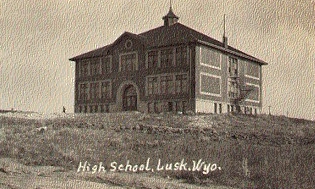
The high school pictured above is now used as the home for Lusk Elks
Lodge No. 1797 at 602 S. Elm. The landscaping has improved. There are
actually trees and grass in front of the building.
|