| Photos From Wyoming Tales and Trails (continued from preceding page)This page: Shoshoni, Riverton. |
 |
|
| Photos From Wyoming Tales and Trails (continued from preceding page)This page: Shoshoni, Riverton. |
|
| Ludwig Collection* | Union Pacific* | Big Piney, 1885-1920* |
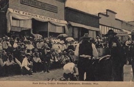
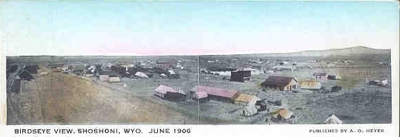 Shoshoni, Wyo., 1906 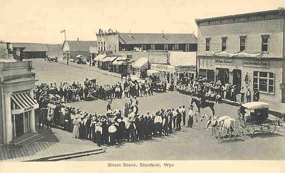 Rock Drilling Contest, Shoshoni, 1908 Across the street from the viewer is the C. H. King Company and the First National Bank. Note that the town had two banks. Charles Henry King (1853-1930) was the paternal grandfather of President Gerald Ford and previously operated merchantile businesses in Fetterman City and Douglas. President Ford's mother divorced his father, Leslie L. King, a wool dealer in Omaha, and upon his mother's remarriage Ford adopted his stepfather's name.
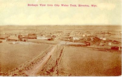
By 1906 Asmus Boysen had commenced the construction of his dam in the Wind River Canyon to provide electrical power to the area, gold and copper mining in the Owl Creek Mountains to the north of the town had commenced, and the Wyoming and Northwestern Railroad had run its line from Casper to Lander so that the area would be served by two railroads. Arnold Oliver Heyer (1877-1938), the publisher of the above panoramic photo, was active in the Republican Party and was an alternate delegate to the 1932 Republican Convention. Photo of the Heyer-Berger building constructed in 1908 further below on the page. Riverton, pictured to lower right, at the time of the panoramic photo at the top of the page, did not exist. Riverton was founded on August 15, 1906, as a tent town and was named Wadsworth after the railroad station manager. Within two weeks it was renamed Riverton. Today Riverton has a population of over 10,000 and Shoshoni barely 500.
The Wind River is known by two names. Below the Wind River Canyon the river is known as the Big Horn. Above the entrance to the canyon is it known as the Wind River. The reason is that early explorers coming up the Missouri came across the stream and named it the Big Horn. Explorers in the Wind River Basin named the river the Wind River. It was only after the names stuck that it was discovered that it was the same stream. To add to the confusion Shoshoni is not on the Shoshoni River which is near Cody, but is on Poison Creek. The Shoshoni River, originally called Stinking Water, was renamed at the insistance of residents of Cody who thought the name might not be good for business. Of course, however, this eliminates confusion with other streams called Stinking Water Creek in Laramie, Natrona, and Converse Counties and in Hayes County, Nebraska, along which the old Texas Trail to Ogallala passed.
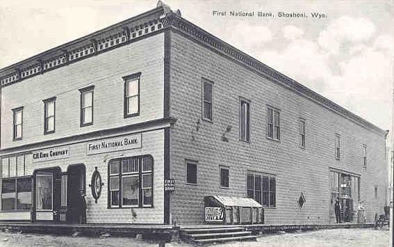 C. H. King Company and First National Bank, Shoshoni, 1909 The building occupied by C. H. King and the Bank is now on the National Historic Register and is occupied by a drugstore and ice cream parlor famous for its real milkshakes, not a miracle of modern chemistry.
In 1907 Henry C. Beeler, the state geologist, noted the prospects for mining near Shoshoni:
Copper Mountain is the name locally applied to that portion of the Owl Creek Range of the Wind River Mountains which lies east of the Big Horn River, and has been the scene of active prospecting for both gold and copper for the past year or two. The territory embraced is about twenty miles long by about six or eight wide, and the formations shown are schist, diorite, two distinct granite flows, and the whole skirted by the sedimentaries which overlie the uplift on the north and east sides of the mountain.
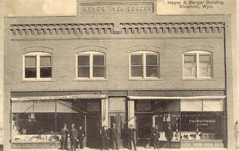 Heyer-Berger Building, Shoshoni, undated The high hopes, however, has faded. The copper industry is, as discussed with regard to Grand Encampment faded in 1908. The gold mining never panned out. At the height of the Cold War there was the Uranium Rush and Fremond County became the leading producer of uranium in the United States. But even that has faded. Jeffrey City in the southern part of Fremont County arose and has again faded into obscurity. In the area of Shoshoni the railroad from Riverton to Lander was abandoned in in 1977. In 1993 the Shoshoni segment was sold to the Badwater Line until it too was abandoned and the right-of-way was accepted by Fremont County as part of the Rails to Trails program.
 Shoshoni, undated |


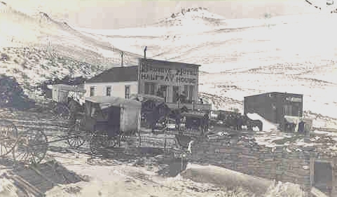 Halfway House Hotel, Owl Creek Mountains, approx. 1908