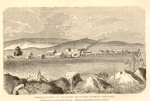
Sherman, Wyoming Terr., 1874
The coming of the railroad had a drastic impact upon Wyoming. As the Railroad progressed across
the Territory small towns and cities sprang up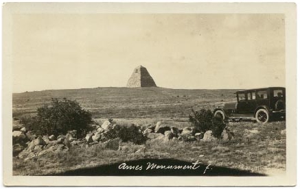 at the railhead to serve the
needs of the Railroad, the graders and others drawn to the area. Such was
Sherman, seventeen miles east of
Laramie and located at the highest point on the Railroad between the two coasts, 8,262 ft. above sea level.
Ames Monument, Sherman, Wyo., photo by
Henning SvensonFor discussion of Henning
Svenson, see Laramie II.
Within 15 months of the railroad reaching Sherman Hill, the town boasted railroad
machine shops, a Wells Fargo express office, a newspaper, a millinery store and 2 two-story hotels,
the Sherman House and the Summit House. They were not
much as hotels but featured decent meals. Next door to the hotels was
a bar. Today, the existence of the town is marked only by the Ames Monument, pictured
above left and below, constructed by the Union Pacific in 1882; the foundation stones for
the railroad's windmill; and the cemetery. See photos of windmill foundation and
cemetery below.
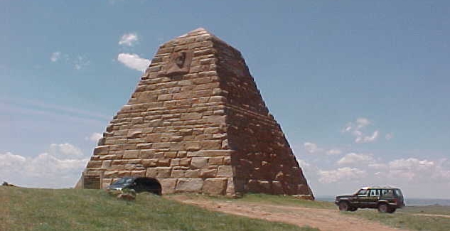
Ames Monument, 2001, photo by Geoff Dobson
When the writer arrived at the above scene for the purpose of taking
some photos, an individual from the blue minivan was relieving himself on the
monument. Perhaps, but not likely, he was expressing his opinion from an historical perspective of the Ames
Brothers in whose honor the monument was erected. Indeed,
in an historical context one might not feel too kindly of Oliver Ames, Jr. (1807-1877) and
Oakes Ames (1804-1873). The two were at the very center of one of the greatest financial scandals in the
history of the American body politic, a scandal which implicated in allegations of
bribery the Vice President of the United States Schuyler Colfax, the Speaker of the
House of Representatives James G. Blain, the Republican candidate for vice president Henry Wilson, and
a future president of the United States James A. Garfield, as well as numerous
congressmen.
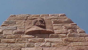
Bas-Relief by August Saint-Gaudens, Ames Monument, photo by Geoff Dobson
In the 1860's the attention of Oakes Ames, a congressman from Massachusetts, and
his brother was drawn to the Union Pacific and the generous subsidies it was receiving
from Congress. The two, having made a fortune in the management of their
father's shovel works which boasted of an average yearly production of over 1,400,000
shovels a year, acquired control over the Union Pacific. As a part of their scheme
to take advantage of the government subsidies, they also acquired control of a
Pennsylvania corporation which they renamed Credit Mobilier. The Union Pacific then
contracted with Credit Mobilier to construct 667 miles of the railroad. The actual
cost to Credit Mobilier was $44,000,000. The contract, using government subsidized funding, was for more than
$94,000,000. In order to preclude Congressional investigation, a large block of
Credit Mobilier stock held by Congressman Ames as trustee was ostensibly "sold" to
influential congressmen for one-third of its actual value. However, the "sale"
did not require actual money. The sales price was paid from the dividends resulting
from the profits on the railroad construction. Ultimately, the scandal was revealed by
the New York Sun. Although no one was indicted, Congressman Ames was censured by
Congress and died several months later, his reputation ruined. The Union Pacific was left heavily in debt.
The monument, itself, was designed by Henry Hobson Richardson, who was also the architect for
the Marshal Field's Store in Chicago. It has been contended that Richardson in his design
was inspired by the philosophy of Frederick Law Olmstead, designer of
New York's Central Park. Indeed, at the time the monument was under construction Olmstead wrote a
member of the Ames Family that it "was customary to commemorate important events by a form of monument * * * *
by bringing together at a place agreed
upon a great quantity of loose field stones and laying them up in the
conical pile known as a cairn."
The bas-reliefs of the Ames Brothers on either side
of the monument were sculpted by August Saint-Gaudens, famous as the designer of the
$20.00 gold piece.
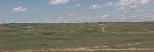
Sherman, 2001, looking west, photo by Geoff Dobson
The town site of Sherman is located 1/4 mile west of the monument and is depicted in the
above photo. In the center of the photo,
 running from left to right, is the former
railroad right-of-way. Toward the left of center may be made out the town site. To the
right of center a trail meanders up the hill to the cemetery. running from left to right, is the former
railroad right-of-way. Toward the left of center may be made out the town site. To the
right of center a trail meanders up the hill to the cemetery.
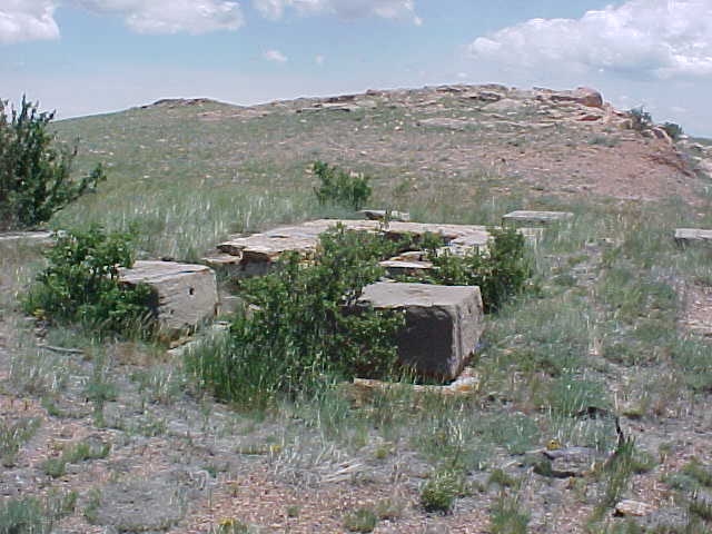
Foundation stones railroad yard, photo by Geoff Dobson
Sherman had as a part of the railroad yards a windmill
the vanes of which had a diameter of 20 feet.
It was used to pump water into a tank holding 50,000 gallons. For a photo of
a similar windmill at Laramie see Photos V.
Additionally, the yard had a roundhouse with five stalls and a turntable. The railroad shops
were required, in great part, by the necessity of double-heading the locomotives up
the steep grade from Laramie. Even today in wintertime the grade on the Interstate out of
Laramie can be an adventure.
In 1901, with the
construction of the Dale Creek embankment, the railroad
tracks were moved several miles away. Today, as indicated by the
above photos, little remains except pottery shards and rusted tin cans. Some artifacts,
however, are newer. On the day that the above photo was taken, a faded Pepsi
can bearing the 1984 football schedule for the Wyoming Cowboys was found. As all
historical artifacts should be, it was left in place.
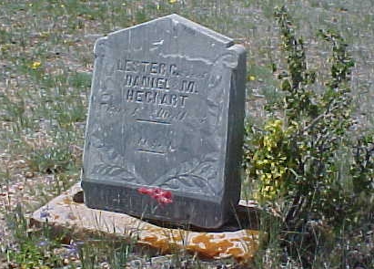 Child's grave Sherman Cemetery, photo by Geoff Dobson
With the abandonment of the town, many of the remains were removed by relatives to
cemeteries elsewhere. The photo is of the grave of a one-year old child who
died in 1888. Today, on the lonely, windswept knoll a 1/4 mile west of Sherman,
Mother Nature provides the flowers.
Directions to Sherman. Exit I-80 at Vedauwoo Road, approximately 16 miles east of
Laramie. Follow signs on graded road on south side of Interstate to Ames Monument. Last portion is on
unimproved road. Town site is approximately 1/4 mile west of monument.
More ghost towns on next page.
|